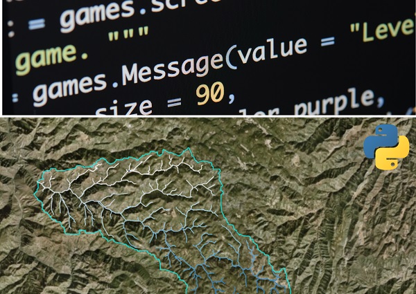
Python has become an essential tool for Geographical Information Systems (GIS) and geospatial analysis, thanks to its versatility, readability, and extensive library support.
In this article, we will delve into how Python can be used for GIS and geospatial analysis, focusing on libraries like GeoPandas and Folium.
We will provide relevant code samples, examples, and even a few smiley faces to keep things interesting  .
.
So, let’s dive right in!
Python and GIS: A Match Made in Heaven
Python is a powerful, high-level programming language with a strong focus on readability and simplicity.
Its easy-to-learn syntax and extensive library support make it the perfect choice for GIS and geospatial analysis.
With libraries like GeoPandas, Shapely, Fiona, and Folium, Python offers a comprehensive suite of tools for working with geographic data.
GeoPandas: A High-Level Introduction
GeoPandas is a Python library that extends the capabilities of Pandas, a popular data manipulation library, to handle geospatial data.
It enables you to work with spatial data using the familiar DataFrame structure, making it easier than ever to perform complex geospatial operations.
To get started with GeoPandas, you need to install the library using the following command:
pip install geopandas
GeoPandas: Working with Geospatial Data
One of the most common tasks in GIS and geospatial analysis is reading and writing geospatial data files.
With GeoPandas, this process is incredibly simple. Let’s load a shapefile containing geographical data for countries:
import geopandas as gpd

# Read the shapefile
countries = gpd.read_file("path/to/countries.shp")

# Print the first five records
print(countries.head())
Once the data is loaded, you can perform various operations, such as filtering, sorting, and selecting data based on spatial criteria. For example, let’s find the countries in Asia:
# Filter countries in Asia
asia_countries = countries[countries['continent'] == 'Asia']

# Print the first five records
print(asia_countries.head())
GeoPandas: Spatial Joins
Another powerful feature of GeoPandas is the ability to perform spatial joins. Spatial joins allow you to combine two GeoDataFrames based on their spatial relationship.
Let’s say we have another GeoDataFrame containing points of interest (POIs), and we want to find the country each POI belongs to:
import geopandas as gpd

# Read the countries and POIs shapefiles
countries = gpd.read_file("path/to/countries.shp")
pois = gpd.read_file("path/to/pois.shp")

# Perform a spatial join
pois_with_country = gpd.sjoin(pois, countries, op='within')

# Print the first five records
print(pois_with_country.head())
Folium: Interactive Maps Made Easy
Folium is a Python library that makes it simple to create interactive maps using the popular Leaflet.js library. With just a few lines of code, you can generate beautiful maps with zoom, pan, and layer control features.
To begin with Folium, install the library using the following command:
pip install folium
Folium: Visualizing GeoPandas Data
Now that you’re familiar with Folium, let’s visualize our GeoPandas data on an interactive map. For this example, we’ll plot the countries of the world:
import folium
import geopandas as gpd

# Read the countries shapefile
countries = gpd.read_file("path/to/countries.shp")

# Create a Folium Map object
m = folium.Map(location=[20, 0], zoom_start=2)

# Add countries to the map
for _, country in countries.iterrows():
    geojson = folium.GeoJson(
        country.geometry,
        tooltip=country["name"]
    )
    geojson.add_to(m)

# Save the map to an HTML file
m.save("countries_map.html")
In this example, we first create a Folium Map object centered at [20, 0] with an initial zoom level of 2.
Then, we iterate through each country in the GeoDataFrame and add it to the map as a GeoJson object.
Finally, we save the map as an HTML file, which can be opened in any web browser.
Folium: Customizing Your Maps
Folium offers numerous options for customizing your maps, including different tile layers, marker icons, and pop-up elements.
For instance, let’s add custom markers for our points of interest (POIs) and display a pop-up with more information when clicked:
import folium
import geopandas as gpd

# Read the POIs shapefile
pois = gpd.read_file("path/to/pois.shp")

# Create a Folium Map object
m = folium.Map(location=[20, 0], zoom_start=2)

# Add custom markers for each POI
for _, poi in pois.iterrows():
    folium.Marker(
        location=[poi.geometry.y, poi.geometry.x],
        popup=f"{poi['name']} - {poi['category']}",
        icon=folium.Icon(color='blue', icon='info-sign')
    ).add_to(m)

# Save the map to an HTML file
m.save("pois_map.html")
In this example, we create custom blue markers with an info-sign icon for each POI, and display a pop-up containing the name and category of the POI when clicked.
Summary
In this article, we explored how Python can be a powerful tool for GIS and geospatial analysis using libraries like GeoPandas and Folium.
We covered various topics, including working with geospatial data, performing spatial joins, and creating interactive maps.
With these libraries at your disposal, you can now harness the power of Python to tackle even the most complex geospatial challenges.
Happy mapping!
Thank you for reading our blog, we hope you found the information provided helpful and informative. We invite you to follow and share this blog with your colleagues and friends if you found it useful.
Share your thoughts and ideas in the comments below. To get in touch with us, please send an email to dataspaceconsulting@gmail.com or contactus@dataspacein.com.
You can also visit our website – DataspaceAI